Measured building surveys: accuracy, clarity and confidence in the built environment
Find out what measured building surveys are, the different types of building surveys available, how laser scanning building surveys are changing the industry and why strong control and methodology remain critical.
Measured building surveys form the backbone of design, refurbishment and property management across the UK. Whether you are extending a commercial unit, converting a heritage building or preparing a portfolio valuation, accurate building surveys provide the foundation for informed decisions.
At first glance, a measured building survey might appear straightforward. Produce floor plans. Draw elevations. Record key dimensions. In reality, the process is far more detailed and far more disciplined.
Measured building surveys today combine traditional survey principles with advanced digital technologies, including laser scanning building surveys and point cloud modelling. They are underpinned by rigorous control networks and delivered to recognised standards such as RICS and IPMS.
In this article, we explore what measured building surveys are, the different types of building surveys available, how laser scanning building surveys are changing the industry and why strong control and methodology remain critical.
What are measured building surveys?
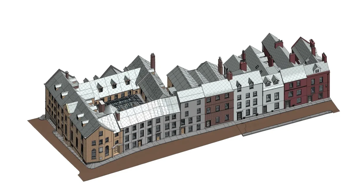
Measured building surveys are detailed surveys that record the physical dimensions and spatial characteristics of a building. They capture geometry, levels, structural features and architectural detail to create accurate drawings and digital models.
Unlike condition surveys, which assess fabric and defects, measured building surveys focus on measurement and representation. The output is typically graphical and dimensional rather than diagnostic.
A professionally executed measured building survey provides:
Accurate floor plans at all accessible levels
External elevations
Cross sections
Roof plans
Internal and external levels
Structural grids and principal heights
The survey becomes the reference dataset for architects, engineers, designers and asset managers. Without it, design development often relies on assumptions. And assumptions create risk.
Why accuracy matters in building surveys
Buildings are rarely perfectly square. Walls taper. Floors fall. Steel deflects. Historical alterations introduce irregularities that are invisible on outdated drawings. Measured building surveys remove guesswork.
For example, when designing a refurbishment within an existing structure, a 20mm discrepancy in a wall position can affect structural calculations, services routing and cost estimation.
Multiply that across a large asset, and the consequences become significant. This is why survey control remains central even in modern laser scanning building surveys.
Primary control points should be established in stable locations and observed using robust GNSS methodology. Heights should be verified through closed-loop levelling and adjustments documented transparently. Secondary control established via closed traverse ensures that all measured data is referenced to a consistent grid.
Even when laser scanning is deployed, the control network defines accuracy.
Types of building surveys
There are several types of building surveys depending on project objectives. Understanding these distinctions helps clients request the correct scope.
Floor plan surveys
Floor plans are the most common form of measured building survey. They show:
Room layouts and names
Door and window positions
Structural columns and beams where visible
Stairs, ramps and changes in level
Ceiling heights and soffit levels
Principal service intakes and distribution boards
Floor plans can be produced in 2D AutoCAD format or developed into 3D models depending on client requirements.
Elevation surveys
Elevation surveys record the external façades of a building. They include:
Door and window reveals
Materials and architectural features
Parapets, cornices and roof profiles
Principal heights and datums
These are particularly important for planning applications, façade refurbishment and heritage conservation.
Section surveys
Cross sections cut through the building to reveal internal relationships between floors, roof structure and ground profile. They are essential where vertical alignment and structural understanding are required.
Roof plans
Roof plans show ridge lines, eaves, plant, skylights, chimneys and drainage features. For complex roof structures, this information can be critical during refurbishment or maintenance planning.
Area measurement surveys
Area measurement surveys focus on quantifying floor areas rather than geometry alone.
These may include:
Gross internal area surveys
Net internal area surveys
Gross external area surveys
IPMS-compliant measurements
All measurements should be undertaken in accordance with current RICS guidance and clearly distinguish inclusions and exclusions. Columns, service risers, stairwells and permanent partitions must be handled correctly. Inaccessible areas should be estimated transparently with clear annotation.
Laser scanning building surveys
Traditional building surveys relied heavily on total stations and manual measurement. While these methods remain valid and are still used where appropriate, laser scanning building surveys now provide greater efficiency, coverage and density of capture.
Terrestrial 3D laser scanning captures millions of points across internal and external spaces. These point clouds form a comprehensive digital record of the building geometry, recording walls, floors, soffits, beams, columns and architectural features in a single coordinated dataset.
Laser scanning building surveys are particularly suited to:
Refurbishment projects with limited existing information
The scanner records geometry at millimetre accuracy when tied into robust survey control. Multiple setups with sufficient overlap ensure reliable registration and elimination of blind spots. Careful planning of scan locations is essential to avoid shadow areas behind the plant, within the ceiling voids or around structural elements.
In addition to static tripod-based systems, laser scanning building surveys can also utilise mobile laser scanners, including handheld SLAM units and backpack-mounted systems. These devices use Simultaneous Localisation and Mapping technology to record geometry while the operator walks through the building.
They are particularly useful in complex internal environments such as hospitals, schools, plant rooms or multi-storey residential blocks where rapid capture is beneficial. Mobile systems significantly reduce time on site and can access tighter spaces more easily than static scanners.
However, efficiency must not come at the expense of accuracy. SLAM-based datasets can accumulate drift over distance if left unconstrained. For that reason, mobile laser scanners should be tied back to established primary and secondary control wherever possible, with check observations taken to known control points across larger floor plates or between storeys.
Used appropriately, handheld and backpack systems complement terrestrial 3D laser scanning rather than replace it, providing flexible capture solutions while maintaining the accuracy standards expected of professional measured building surveys.
The scanner itself is only part of the workflow. The discipline behind control, registration and verification ultimately determines reliability. Checkerboard targets or known control points should be observed from established stations using total station observations. Data must be delivered at a consistent scale factor and aligned to the agreed survey grid. Without these steps, even dense point clouds can mislead.
From point cloud to drawing
A point cloud is not the end product. It is raw data. Experienced technicians convert point clouds into structured outputs, including:
2D floor plans
Elevations and sections
3D AutoCAD models
Revit models
Digital terrain models
This process is often referred to as digitisation. It requires interpretation. Surveyors must distinguish between permanent structures and temporary items. They must understand construction principles and architectural conventions.
For example, ceiling grids may obscure structural soffits. Raised floors may conceal service routes. The survey model should reflect visible and accessible features unless specifically instructed otherwise. Professional judgement remains essential even in laser scanning building surveys.
Revit and BIM integration
Measured building surveys increasingly support BIM workflows. A survey-derived Revit model provides:
Accurate geometry
Defined storey levels
Structural grids
Modelled floors, walls and roofs
Visible service elements
When aligned to the survey control network, the model becomes a reliable basis for design development.
It is important to understand that a survey-derived model reflects observed geometry. It does not represent fabrication detail or hidden construction unless specifically instructed. Level of detail relates to geometric accuracy rather than construction specification.
Clarity around scope avoids misunderstanding later in the project lifecycle.
Roof and UAV integration
Some measured building surveys incorporate UAV imagery to support roof inspection. High-resolution images captured in overlapping grids provide visual reference and orthophotos aligned to survey control. Close-range oblique imagery helps eliminate blind spots around parapets and plants.
When georeferenced correctly, these datasets integrate seamlessly with measured building drawings and models. Again, consistency of the grid and origin is critical.
Internal detail and limitations
No measured building survey can record what cannot be accessed. Rooms that are locked or unsafe should be clearly annotated. Service voids above suspended ceilings may only be measured where accessible. Inaccessible drainage or enclosed cavities remain outside the scope unless specific instruction is given.
Transparency protects both surveyor and client. The survey report should document methodology, equipment used, dates of survey and any limitations encountered. They should also detail the adopted geodetic reference system and vertical datum.
Checks and verifications undertaken should be described clearly. This level of documentation distinguishes professional building surveys from basic drafting exercises.
The relationship between measured building surveys and other survey types
Where multiple disciplines are involved, all datasets should tie back to the same survey control network. A single primary control origin ensures consistency across drawings, models and utility data. Fragmented coordinate systems introduce unnecessary complexity.
Common challenges in building surveys
Despite advances in laser scanning building surveys, challenges remain.
Highly reflective surfaces can reduce scan quality. Tight plant rooms may restrict scanner placement. Large open industrial spaces demand careful registration planning. From a measurement perspective, irregular heritage buildings rarely conform to modern assumptions of verticality and symmetry.
Professional surveyors anticipate these conditions and adapt methodology accordingly. Strong control. Redundancy in observations. Independent checking. Clear reporting. These fundamentals do not change.
Why measured building surveys remain essential
As digital design evolves, the demand for accurate base information increases.
Architects require dependable geometry to develop proposals. Engineers need accurate structural context. Asset managers rely on precise area measurements for valuation and leasing. Measured building surveys provide that foundation.
Laser scanning building surveys have accelerated capture and improved density, but the underlying principles remain rooted in survey discipline. Accuracy is not accidental. It is engineered.
Why work with Academy Geomatics?
Measured building surveys are far more than sets of drawings. They are structured, controlled and verifiable representations of real buildings. Whether delivered as 2D plans, 3D models or fully developed BIM-ready datasets, professional building surveys depend on:
Robust primary and secondary control
Closed traverses and verified levelling
Consistent grid and scale factors
Transparent reporting of limitations
Careful digitisation of point cloud data
At Academy Geomatics, our laser scanning building surveys enhance efficiency and detail but do not replace discipline. In an industry where design decisions and financial outcomes depend on millimetres, measured building surveys remain essential.
They provide clarity, reduce risk and enable confident development. And they form the true starting point for any successful project within the built environment. To find out more about our surveying services and techniques, contact our team.