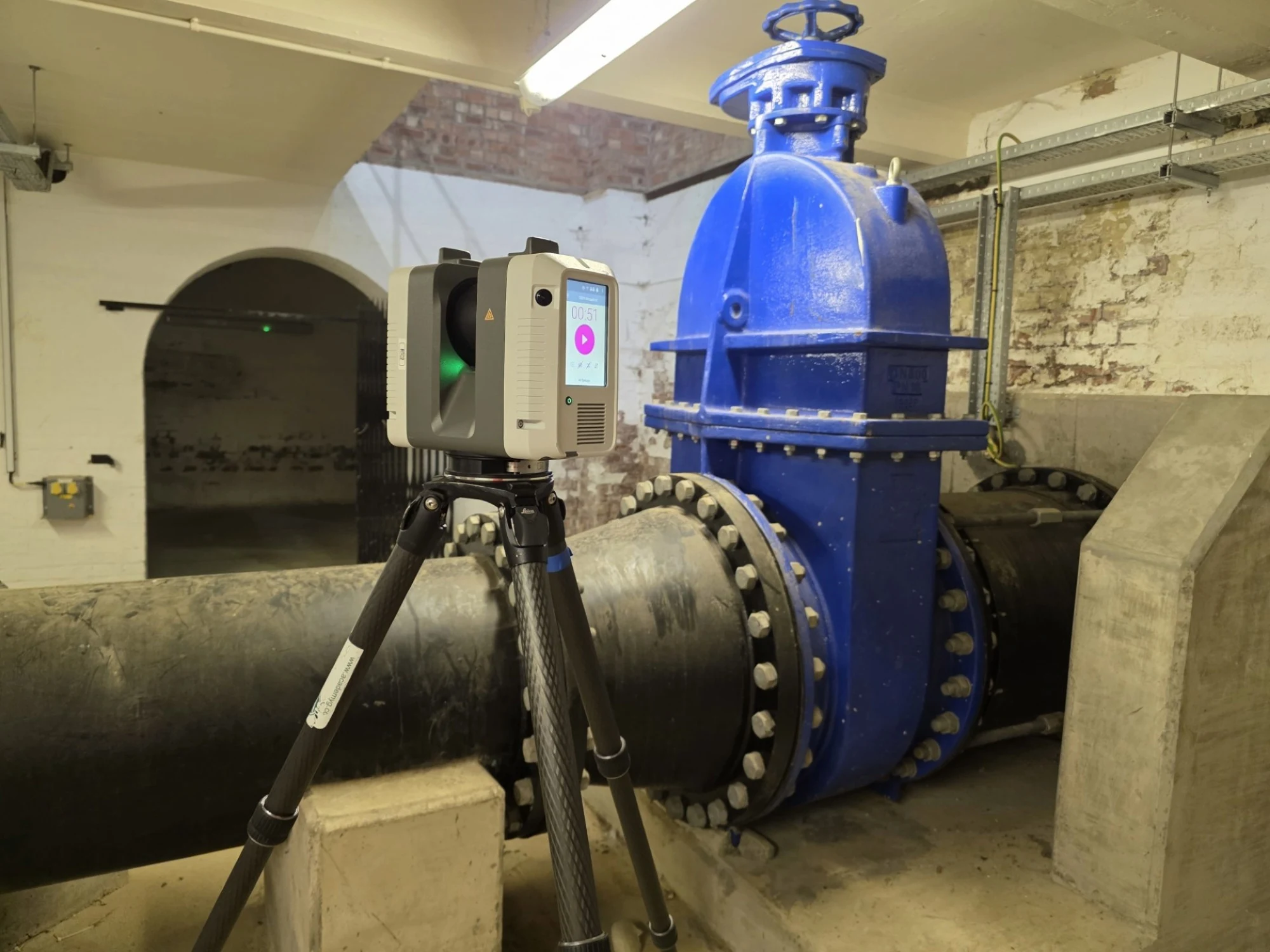
Control considerations for mobile laser scanning
Mobile systems rely on a combination of GNSS, inertial measurement units and laser sensors. While these technologies are powerful, they are not immune to drift or GNSS signal degradation. For this reason, integration with established survey control remains essential.
Mobile laser scanning datasets should be constrained to primary and secondary control points distributed throughout the site. In linear environments, additional centrally located primary control may be required to maintain strong bearings and prevent cumulative orientation drift.
Check observations to known control points along the route provide independent verification that positional integrity has been maintained. Without this framework, even high-density mobile point clouds can suffer from gradual distortion over distance.
Registration and targeting
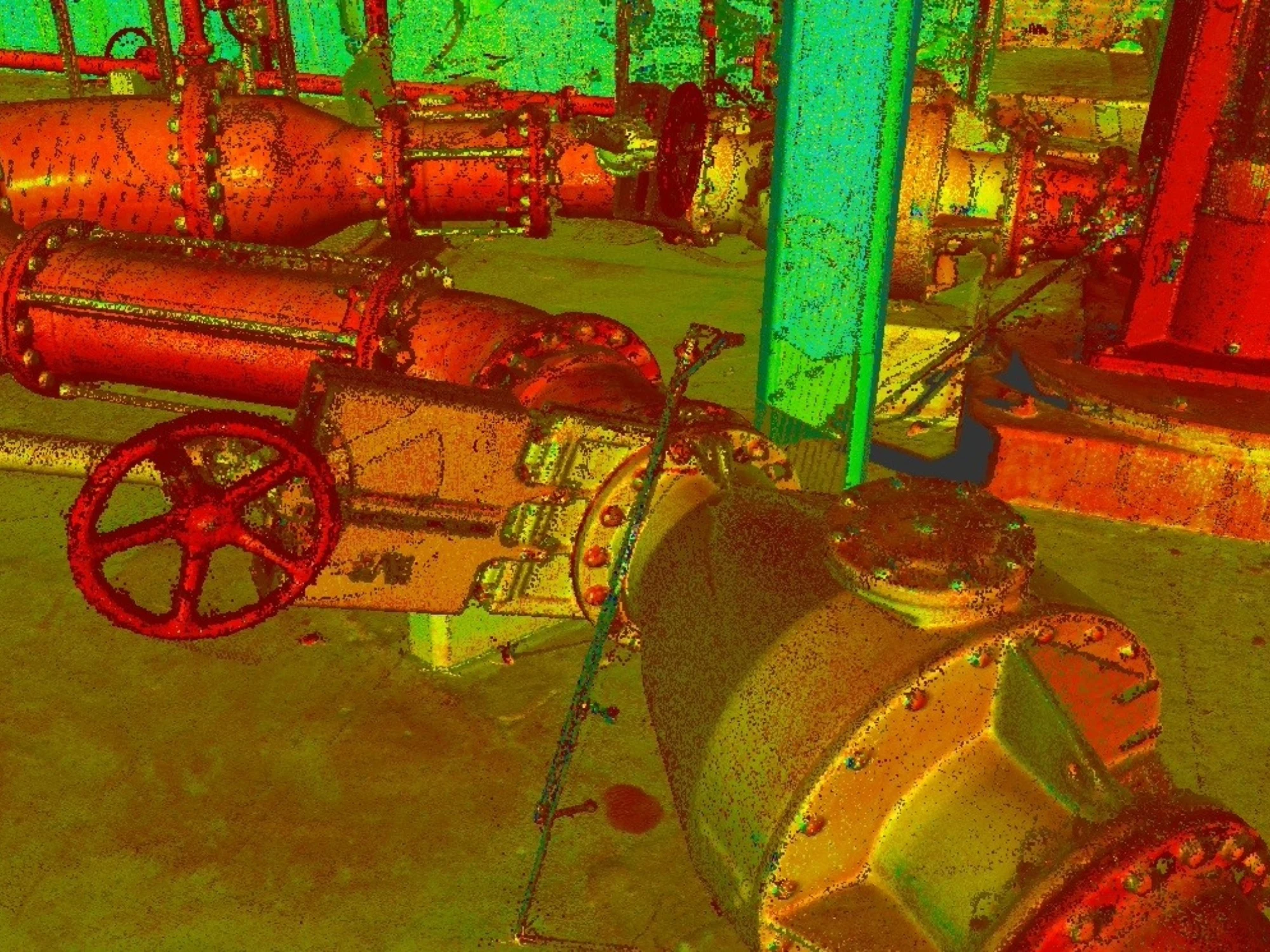
For terrestrial scanning, checkerboard control points installed throughout the site provide fixed references. These should be observed using face left and face right total station observations from established control.
For mobile laser scanning, registration may rely more heavily on control passes and adjustment to known coordinates. In both cases the objective is the same. The point cloud must sit within a verified coordinate system tied to the wider survey grid.
Consistency of origin and scale is critical. Data should be delivered at a scale factor of 1 unless there is a clearly justified alternative requirement. Introducing arbitrary scaling is one of the most common causes of downstream modelling errors.
Integrating laser scanning with other survey data
Laser scanning rarely stands alone. Point clouds are often combined with:
To maintain consistency, all datasets must reference the same origin and grid. A single primary control station should be used as the origin when scaling survey data across disciplines. Fragmented coordinate systems introduce confusion and undermine confidence in the deliverables.
From point clouds to usable deliverables
A point cloud is rich but not always convenient for end users. Post-processing transforms raw laser scanning data into structured outputs including:
- 3D topographical surveys in DWG format
- 3D asset models in Revit
- Digital terrain models
- Digital elevation models
- Structural health reports
- Volume analysis
- Condition assessments
Digitisation requires experienced technicians who understand geometry and construction. Automated extraction tools can assist but professional oversight remains essential where precision matters.
Quality assurance and documentation
Professional laser scanning is defined as much by documentation as by data capture. Survey reports should clearly describe:
- Primary control methodology
- GNSS observation sessions and tolerances
- Traverse closure statistics
- Levelling misclosures and adjustments
- Registration residuals
- Survey grid and origin
- Scale factors applied
Witness diagrams for primary control should be prepared. Horizontal and vertical control diagrams provide visual clarity on network strength. Transparency is part of quality.
Common pitfalls in laser scanning and mobile laser scanning
Technology can create a false sense of security. Dense data does not automatically mean reliable data. Common issues include:
- Weak or isolated control
- Reliance on single GNSS observations
- Open traverses without redundancy
- Insufficient scan overlap
- Over reliance on cloud-to-cloud registration
- Failure to constrain mobile datasets to fixed control
- Inconsistent scale factors
Each of these weaknesses can introduce small shifts that accumulate across large projects. Best practice is built on redundancy and independent verification.
Why laser scanning and mobile laser scanning are now standard
Clients increasingly expect laser scanning as part of survey scope. The reasons are practical:
- It reduces time on site.
- It improves safety by limiting repeated access to hazardous areas.
- It captures comprehensive data in a single visit.
- It supports BIM and digital twin workflows.
- It enables remote collaboration.
Mobile laser scanning extends those benefits across linear infrastructure and large external environments. Most importantly, when underpinned by rigorous control, it delivers confidence.
The discipline behind the technology
Laser scanning and mobile laser scanning are powerful tools. But tools alone do not guarantee accuracy. These principles must also be followed:
- Strong primary control observed in multiple sessions
- Closed traverses with verified misclosures
- Spirit levelling with documented adjustments
- Checkerboard targets observed from established stations
- Mobile datasets constrained to fixed control
- Scale maintained at 1 to 1
- Independent checks embedded throughout the workflow
These principles transform raw laser data into dependable survey information.
Why work with Academy Geomatics?
Laser scanning and 3D laser scanning have redefined how we capture the built environment. Dense point clouds now provide extraordinary levels of detail across buildings and infrastructure.
Mobile laser scanning extends this capability across highways, rail corridors and complex external environments. But the real value lies not in the number of points captured. It lies in the integrity of the control behind them.
When survey control is established rigorously, when closed loops replace open traverses, when adjustments are documented transparently, when mobile datasets are verified against fixed stations, and when scale and origin remain consistent across all deliverables. That is when laser scanning becomes more than impressive visuals. It becomes trusted data. And trusted data underpins confident decisions.
Want to know more about how we utilise 3D laser scanning and point clouds to deliver reliable datasets, every time? Contact us today.