10th Dec 2025 Technology
CCTV drainage surveys: Seeing what can’t be seen
A practical, data-driven approach to underground drainage investigation
Drainage infrastructure is one of the most critical yet least visible elements of the built environment. Buried beneath roads, buildings and industrial sites, drainage networks often operate out of sight for decades, until a problem arises.
When blockages, collapses, infiltration or unexplained flooding occur, assumptions and historical records are rarely enough. What is required is direct visual evidence. This is where CCTV drainage surveys play a crucial role.
At Academy Geomatics, CCTV drainage surveys form an integral part of our underground investigation services, providing clients with accurate, impartial information about the condition, layout and integrity of drainage systems.
Whether supporting planned maintenance, redevelopment, condition assessment or emergency investigation, a CCTV drainage survey remains the most reliable method of understanding what is actually happening below ground.
This informative blog post explains what a CCTV drainage survey involves, when they are used, how they are delivered and why high-quality survey methodology matters.
Drainage systems are prone to deterioration over time. Changes in loading, ground movement, root ingress, historic construction methods and poor maintenance can all compromise performance. Unlike above-ground assets, early signs of failure are often invisible at the surface.
Common reasons clients commission a CCTV drainage survey include:
In many cases, clients are working from incomplete records, assumptions or legacy drawings that no longer represent the actual system in place. A CCTV drainage survey provides certainty.
A CCTV drainage survey is a non-intrusive, visual inspection of underground pipework using specialist camera equipment deployed from manholes, chambers or access points. The camera travels through the pipe, recording high-resolution footage and capturing detailed information about condition, defects and geometry.
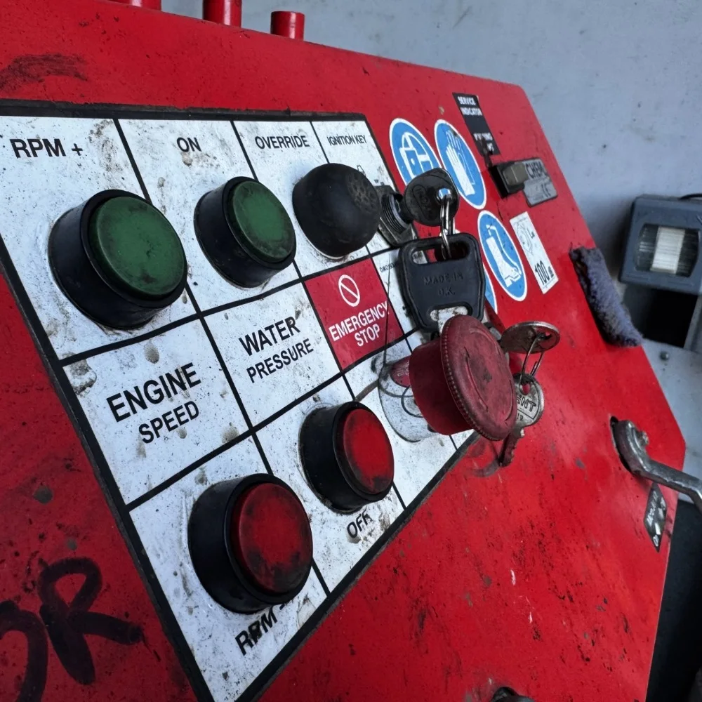
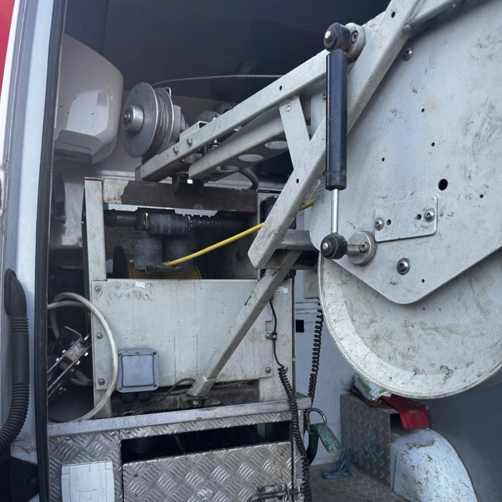
At Academy Geomatics, surveys are carried out using van-mounted and crawler-based CCTV systems, capable of inspecting pipework ranging from small diameter laterals through to large trunk sewers.
Our surveys are planned and executed in line with standard industry practice, using trained operatives and calibrated equipment. The objective is simple: to provide an accurate, repeatable and impartial assessment of the drainage network.
As with all survey disciplines, a successful CCTV drainage survey begins before anyone arrives on site.
Prior to mobilisation, we review:
This helps define the appropriate equipment, crew size and survey approach.
A CCTV drainage survey relies on safe, unobstructed access to chambers and manholes. Where covers are sealed, damaged or buried, this must be resolved before survey works begin. Where jetting is required to clear access routes, this is planned into the works.
All works are completed under a safe system of work, with risk assessments and method statements in place. Confined space entry is avoided unless explicitly scoped and approved, with surveys typically undertaken from surface access only.
A clean pipe is essential for a meaningful CCTV drainage survey. Prior to inspection, high-pressure water jetting is used where necessary to remove debris, silt, grease and minor obstructions that could otherwise obscure the camera view. Jetting is not intended as a repair process but as a preparatory step to allow inspection.
It is important to recognise the limitations here: jetting facilitates inspection but does not guarantee permanent clearance of defects such as root ingress, collapses or displaced joints.
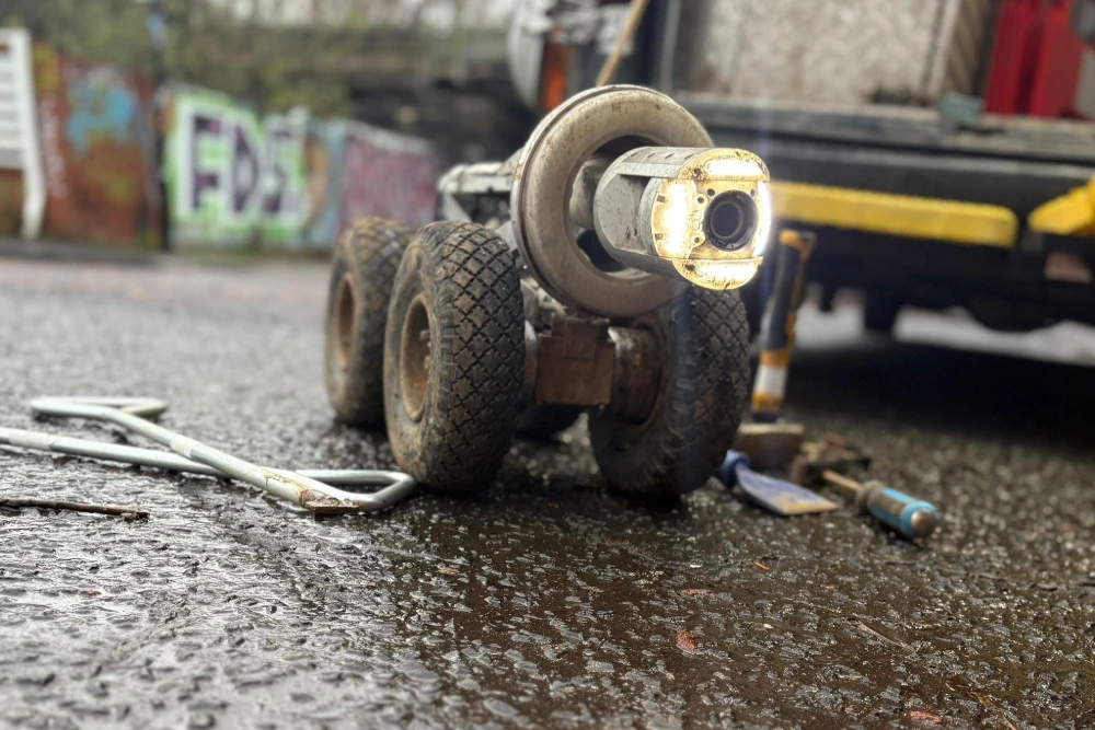
Depending on pipe diameter and access constraints, we deploy:
All of our cameras are equipped with adjustable lighting, distance measurement and pan/tilt capability, allowing defects to be examined in detail.
The camera is introduced into the pipework and travels along the pipe, either driven remotely or pushed manually depending on conditions. Throughout the inspection, the operator records:
All observations are timestamped and distance-referenced, allowing precise defect location.
Drainage CCTV surveys routinely identify issues that cannot be inferred from surface inspection alone. Common findings include:
Each defect is recorded with clear commentary and supporting imagery to provide the client with actionable information.
Survey findings are compiled into a structured report, typically including:
The reporting format is designed to be clear, concise and suitable for engineers, asset managers and designers alike. Where required, condition grades can be assigned to support prioritisation of remedial works or long-term asset management planning.
It is important that drainage CCTV surveys are understood for what they are – and what they are not. A CCTV drainage survey is an exclusively visual inspection. Certain limitations apply:
At Academy Geomatics, all limitations are clearly stated in the final report. Transparency is critical. Clients should be able to rely on the data without misinterpreting its scope or certainty.
One of the strengths of Academy Geomatics is our ability to integrate CCTV drainage survey data with other survey outputs.
CCTV results are often combined with:
This integrated approach provides a comprehensive understanding of below-ground conditions and supports informed decision-making.
CCTV drainage surveys are regularly undertaken across a wide range of environments, including:
In each case, the underlying requirement is the same: accurate, defensible information about underground drainage assets.
On completion of a CCTV drainage survey, clients receive a full digital record pack, typically including:
All deliverables are issued electronically via secure download or cloud-based sharing platforms, in line with modern data management practices.
Not all drainage CCTV surveys are equal. Poor lighting, rushed inspections, or incomplete reporting can leave clients with data that is difficult to interpret or unreliable. At Academy Geomatics, we focus on:
The objective is not merely to record footage, but to provide information that can be used confidently to support decisions.
The CCTV drainage survey remains one of the most effective tools for understanding underground drainage systems. They provide direct visual evidence, reduce uncertainty, and allow informed planning of maintenance, repair, or redevelopment.
In an era where underground infrastructure is increasingly complex and critical, reliable drainage data is not a luxury, but a necessity. We deliver CCTV drainage surveys as part of an integrated, professional survey service, supporting clients across the UK with clear, reliable, and practical underground intelligence.
If you need to understand what is happening below ground, a CCTV drainage survey is often the most direct place to start. Contact us to get your project moving.
For more information about our geospatial services, or to commission a survey or discuss a project, please get in touch.