


Northumbrian Water Group Water
Advanced sewer profiling using LiDAR and sonar
Our innovative float-based inspection system provided Northumbrian Water Group with detailed 3D sewer models, enabling proactive maintenance and cost savings.
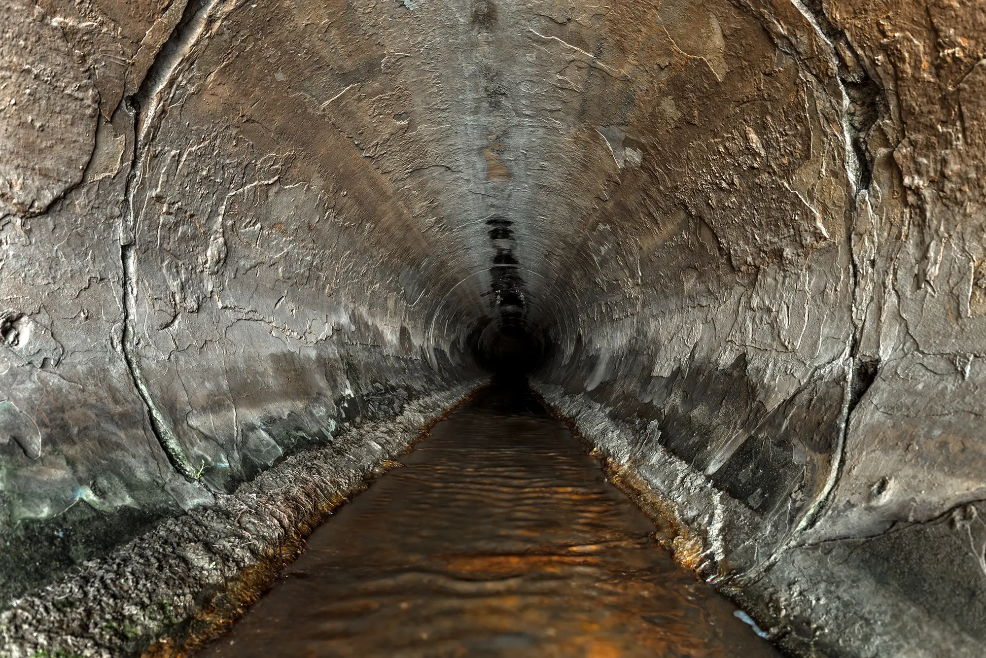
Northumbrian Water Group (NWG) commissioned us to conduct advanced sewer profiling surveys across two key locations: Bishopwearmouth (Phase 1) and Hebburn (Phase 2). The work was carried out in 2024 and 2025 and employed our state-of-the-art float-based inspection system, which integrates LiDAR, sonar and high-definition cameras into a self-contained mobile platform.
NWG experienced capacity and flooding events, as well as blockage issues in parts of its sewer network, due to suspected silt build-up. Initial manual inspections proved insufficient owing to access limitations and safety concerns. With increasing pressure to manage assets more efficiently and reduce environmental impact, NWG sought an accurate, technology-driven solution.
We were selected for our innovative approach to water infrastructure surveying. The ability to capture simultaneous above- and below-water data in high resolution made our system uniquely suited to the task.
We deployed our float-based inspection system in Bishopwearmouth, integrating LiDAR, sonar and 4K video imaging. The phase focused on:
The resulting dataset enabled initial mapping of sediment levels and pipe conditions.
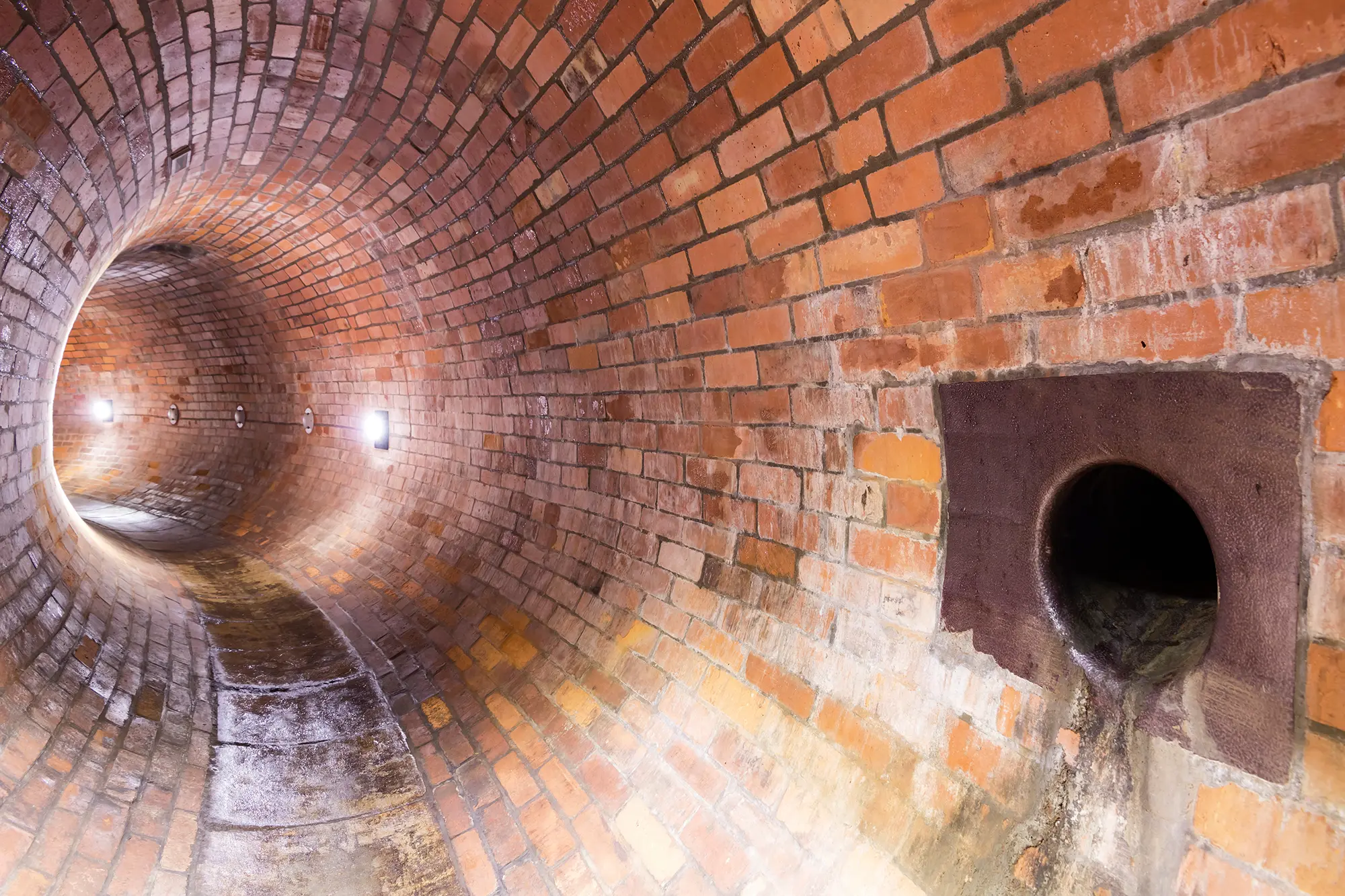

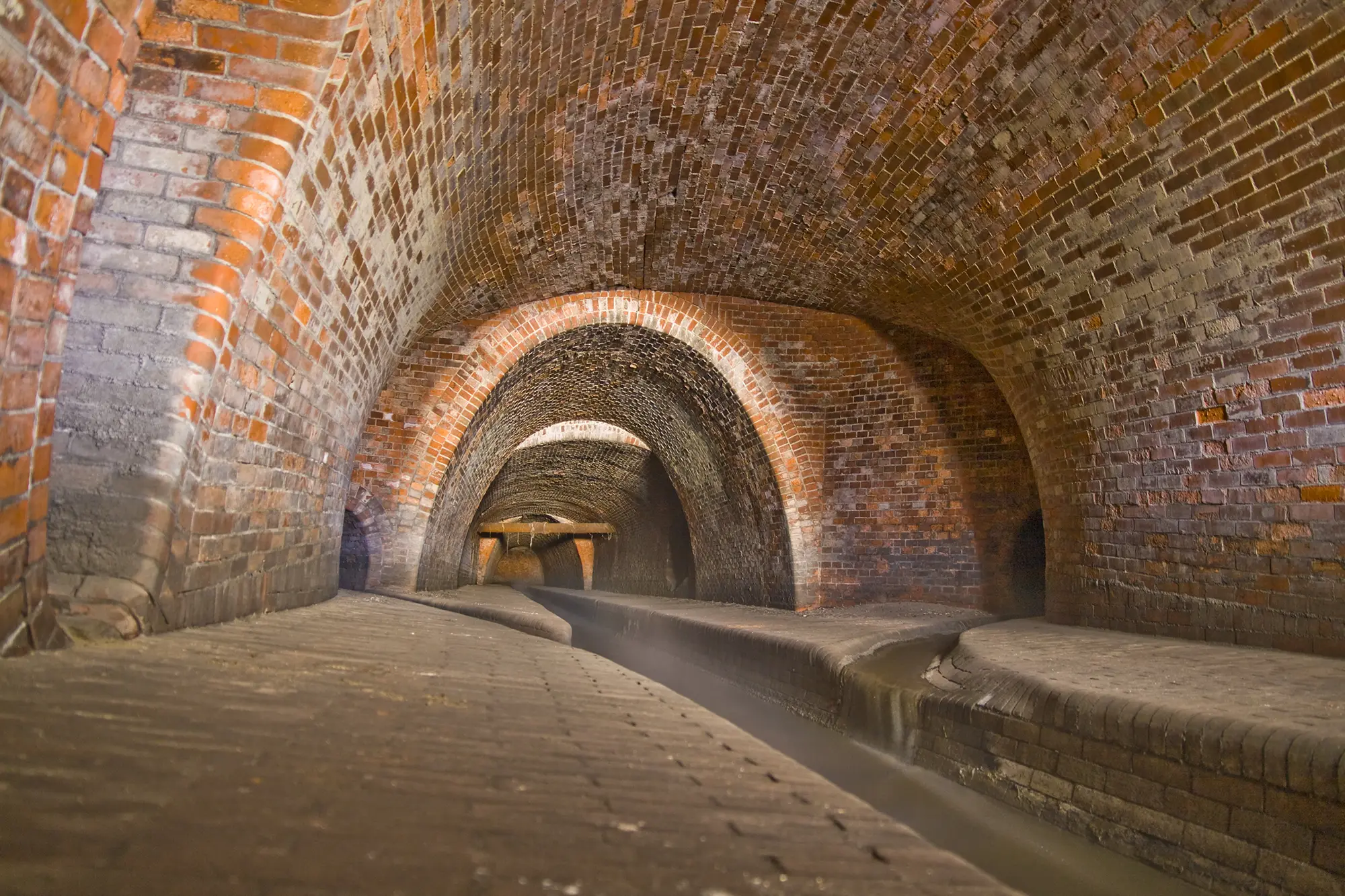
Building on the success of Phase 1 at Bishopwearmouth, the Hebburn project introduced upgraded LiDAR and sonar sensors to achieve more detailed profiling of submerged sections and complex pipe geometries. The advanced float-mounted system captured complete 360° imagery, producing fully correlated datasets that merged detailed structural profiles with precise silt-volume mapping. All data from both phases were processed to generate comprehensive 3D models of the sewer infrastructure, equipping Northumbrian Water Group with actionable insights for strategic maintenance planning.
The sewer profiling supplied NWG with a digital model pinpointing deformities, blockages and silt accumulation. This enabled targeted cleaning, optimised scheduling and significantly reduced maintenance costs. By employing the float-mounted solution, the need for confined-space entry was minimised, enhancing health and safety for operatives. Integrating LiDAR and sonar data delivered high-resolution insights, supporting more efficient, data-led decision-making.
The sewer profiling enabled targeted cleaning, optimised scheduling and significantly reduced maintenance costs.
This technology facilitated proactive, targeted maintenance, lowered costs and safety risks, and underpinned data-driven decisions for long-term asset resilience in the North East. NWG commended the speed, safety and clarity of our outputs, noting their positive impact on planning and environmental compliance.
Discover our most recent land surveying projects. These case-studies demonstrate precise, efficient solutions to complex challenges.

For more information about our geospatial services, or to commission a survey or discuss a project, please get in touch.


