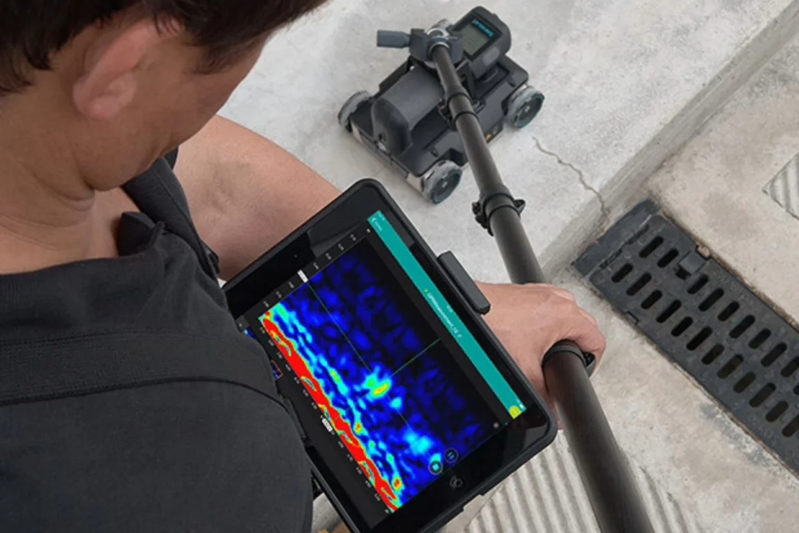
Conducting a Ground Penetrating Radar survey at Gateshead flyover
We leveraged our expertise to overcome the complex logistical and structural challenges of conducting a PAS128:2022 utility mapping and GPR survey of the Gateshead flyover.
Project background
Gateshead flyover is a structure familiar to anyone travelling through Tyneside. For decades, it has carried traffic above the town centre, quietly doing its job while the urban landscape grew and changed around it. But in recent years, its reputation has shifted.
Much maligned, clearly ageing and now closed to the public, the flyover has become a symbol of long-term wear, structural decline and the challenges facing local authorities responsible for maintaining infrastructure built in a very different era.
For Academy Geomatics, however, the closure of the flyover created an unusual opportunity, and a specific set of challenges, when we were commissioned to undertake a PAS128:2022 utility mapping survey under the structure and along its surrounding approaches.
Having already completed detailed topographical surveys of the area in previous years, we were well placed to return and extend our work into a full Ground Penetrating Radar survey (GPR survey) and utility detection exercise to support ongoing assessment and future planning.
This case study will set out what we delivered, the specialist methods we used and the practical realities of mapping buried infrastructure beneath (and around) a structure that is no longer fully accessible, rarely straightforward, and surrounded by dense traffic routes that need careful management.
A flyover with a complicated present
The Gateshead flyover was an important part of the region’s transport network, but its current condition has forced its closure to the public. For surveyors, this presents a mix of advantages and disadvantages.
On the one hand, reduced pedestrian and vehicle movement can make access simpler and certain survey tasks safer. On the other hand, closures often indicate deteriorated infrastructure – spalled concrete, unstable elements, standing water, inaccessible areas and localised hazards that need careful assessment before work begins.
Before undertaking any new PAS128 utility mapping survey, our starting point is always a comprehensive desktop study – collating asset records, statutory plans, historical mapping and our own previous datasets.
Because we had already measured much of the area while undertaking topographical works, we were able to build on an established survey control network, consistent with RICS and industry best practice, following the methodologies used across our specification documents. This gave us a strong technical baseline before we even stepped back on site.
Project aim: A full PAS128:2022 utility mapping survey using Ground Penetrating Radar
Our remit was to undertake a PAS128 utility mapping survey across selected parts of the flyover structure, its approaches and adjacent public areas. The aim was straightforward:
Locate, identify and accurately map all underground utilities using PAS128-compliant methods, producing a clear, reliable dataset to support future planning and structural assessments.
As required under PAS128:2022, our detection work followed the specifications for M-series detection methods (primarily M3P) with the combined use of EML, Ground Penetrating Radar, RFL and, where feasible, validation in accessible surface features such as chambers and covers.
The final deliverables included:
Combined 2D & 3D AutoCAD DWG files
Clear differentiation between Quality Levels D, C, B4–B1P
Depth estimates where achievable
Consolidated desktop records and supporting information
A factual survey report outlining methodology, limitations and conditions
Challenges of the Gateshead flyover site
Site restrictions under the structure
The underside of the flyover presented the most significant constraint. While some areas were relatively clear, others exhibited:
Low headroom
Poor lighting
Standing water
Trip hazards
Isolated structural deterioration
Narrow access corridors
Overgrown vegetation
Busy adjacent roads
Although the flyover itself is closed, the approaches and connecting roads remain extremely busy, serving as a major route into Newcastle upon Tyne. This made carriageway utility detection more complex.
Deploying traditional push-cart Ground Penetrating Radar on a live carriageway is unsafe without Traffic Management (TM). To avoid unnecessary disruption and cost, we deployed our vehicle-mounted GPR survey system, which allows:
Safe, mobile acquisition
Rapid coverage of long linear sections
Minimal interruption to traffic
Full PAS128-compliant data capture
This approach is particularly effective for Ground Penetrating Radar surveys on main roads, dual carriageways and high-speed routes, and it proved invaluable in Gateshead.
Public-accessible zones
Several pedestrian areas, footpaths and open public spaces needed surveying. Although quieter than usual, these zones still required:
Careful management of pedestrian flow
Clear survey signage
Use of EML and RFL in open areas
Controlled deployment of GPR survey systems where ground conditions allowed
Longer grass and uneven surfaces in certain peripheral areas affected GPR signal performance slightly, but the combination of techniques ensured complete coverage to PAS128 expectations.
Mixed ground conditions
As we often encounter in urban areas, the site contained:
Reinforced concrete
Multiple resurfacing layers
Made ground
Patch repairs
Historic utilities
Service corridors running parallel or overlapping
Each of these can introduce complexity or noise into the GPR dataset. Through post-processing and cross-validation with EML and RFL results, we were able to confidently map and classify utilities across the survey coverage.
Methodology: How we delivered the GPR survey
1. Survey control and existing data
The survey was tied into our previously established local (SF=1) survey grid, in line with the specifications used throughout our formal survey documentation. Levels were related to Ordnance Datum and checked against existing permanent control where available.
All records were interpreted and combined into a preliminary utilities overlay, helping guide field detection.
3. Site reconnaissance (QL-C)
We inspected:
Chambers
Covers
Cabinets
Street furniture
Duct entries
Visible infrastructure
This reconnaissance was used to confirm or correct desktop data, establishing QL-C positions across the site.
4. Detection survey (QL-B)
To achieve the required PAS128 quality levels, we deployed vehicle-mounted GPR, which can be used in pedestrian areas, under-flyover spaces, narrow zones and for localised detection in constrained areas.
This system is particularly effective for carriageways, dual carriageways and areas unsuitable for slow manual survey. It allowed a detailed Ground Penetrating Radar survey across areas that would otherwise have required traffic management.
Push-cart GPR remains one of the most reliable tools for high-resolution subsurface imaging where access allows. Electromagnetic Locators (EML) were also used in passive and active modes to detect LV and HV electricity, metallic water/ gas services and communications ducts with draw wire or metallic components.
Where EML indicated utilities not corresponding with GPR survey results, we completed additional sweeps to verify the signal. Radio-Frequency Location (RFL) was applied where appropriate to trace certain utilities unable to be energised via EML generator.
5. Data integration and post-processing
All datasets – vehicle GPR, push-cart GPR, EML and RFL – were combined in post-processing software to assign:
Horizontal accuracy
Depth estimates where achievable
Quality Level classification (B4, B3, B2, B1P where applicable)
Our processing workflow followed the principles set out in PAS128 specifications and methodology documentation.
Survey outcome & key findings
Across the full survey area, we successfully mapped:
Water mains and service connections
Gas infrastructure
Electricity (LV/HV)
Multi-duct comms corridors
Drainage and surface water lines
Legacy utilities consistent with historic mapping
Redundant routes still visible in GPR but not in current records
Service corridors beneath and around the flyover footprint
Utility depths and confidence levels
Depth estimates were achievable across large parts of the dataset, particularly where Ground Penetrating Radar survey signals remained clear and the ground construction was compatible with radar penetration.
Where reinforced concrete or poor ground conditions limited depth reliability, utilities were assigned appropriate QL classification.
Value to the client
The final PAS128 utility mapping survey now provides:
A single, consolidated dataset of verified underground utilities
Clear indication of which utilities are confidentially located
A practical basis for structural planning and future works
Reduced risk for excavation and intrusive inspection
A long-term spatial framework tied to robust survey control
Why this project highlights the importance of full PAS128 compliance
Urban structures of this scale often contain layers of undocumented or partially recorded services. Without a structured approach such as PAS128, the risk of the following is significantly increased:
Striking live utilities
Misidentifying redundant infrastructure
Overlooking deeper or shielded services
Misinterpreting historical records
By using multiple detection methods, including Ground Penetrating Radar, EML, RFL and vehicle-mounted GPR, we were able to overcome the varied constraints of the Gateshead Flyover and deliver a clear, defensible, technically robust dataset.
This reinforces a key point: No single technique is sufficient in isolation. True utility mapping requires a combined, layered, cross-validated approach.
How can Academy Geomatics help?
The PAS128 utility mapping survey at the Gateshead flyover demonstrates the capability of Academy Geomatics to work in constrained, complex and partially inaccessible environments while maintaining both safety and technical standards.
From the combination of vehicle-mounted Ground Penetrating Radar and manual GPR survey techniques to the structured application of PAS128 methodologies, the project represents a comprehensive, methodical and well-coordinated exercise in underground utility detection.
The flyover may be closed, but the area’s future development depends on accurate data that supports structural assessments, informs investment decisions and ensures any future works are completed safely and efficiently. We are proud to have delivered that certainty.
If you’d like support with a Ground Penetrating Radar survey or a fully PAS128-compliant mapping exercise anywhere in the UK, our team is ready to assist.
Showcasing our expertise
Discover our most recent land surveying projects. These case-studies demonstrate precise, efficient solutions to complex challenges.